
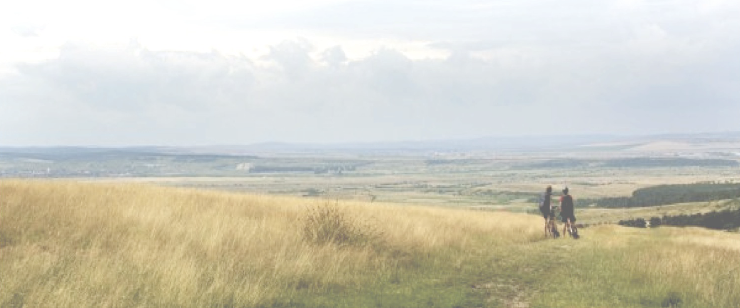
1. What is a greenway?
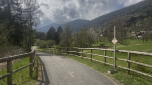
Greenway, Parco Regionale Adamello, Italia
A greenway is a linear, traffic-free (or low-traffic) corridor reserved for soft, non-motorized mobility — walking, cycling, horse-riding, skating, and use by wheelchairs and pushchairs. Greenways are typically built along transport routes that already existed in the past: disused railway lines, canal towpaths, riverbanks, old military or rural roads, and minor agricultural tracks. Reusing this pre-existing right-of-way is precisely what makes greenways affordable and easy to build: the land is already linear, already publicly owned in many cases, and often comes with valuable heritage — old stations, bridges, tunnels, and lock-keepers’ houses — that can be restored and given a new life.
Two features define the concept. The first is spatial configuration: a greenway is fundamentally linear, which is what allows it to connect things — green areas, the city with the countryside, residential neighbourhoods with schools, stations, and town centres. The second is multifunctionality: a good greenway is never just a “way” for getting from A to B. It simultaneously works as transport infrastructure, an ecological corridor, a tourism product, a recreation and sport facility, a vehicle for historical-cultural heritage, a landscape asset, an educational tool, and a contributor to public health and wellbeing. Because of this, greenways are consistently designed to be accessible to all — including people with disabilities, older people, and small children — through gentle gradients, hard or well-compacted surfaces, resting points, and tactile or audio wayfinding for visually impaired users.
2. Examples across Europe
The greenway movement began with the conversion of disused railway lines, which offer gentle, continuous, obstacle-free corridors ideal for cycling and walking. By the mid-2010s, European greenway associations counted more than 1,700 recovered railway routes totalling over 20,000 km across 19 countries; a selection is shown below.
|
Country |
Recovered routes |
Total km |
|
Germany |
731 |
4,900 |
|
Spain (Vías Verdes) |
122 |
3,400 |
|
France (Voies Vertes) |
185 |
3,400 |
|
Sweden |
133 |
2,200 |
|
United Kingdom |
157 |
1,600 |
|
Italy |
75 |
1,000 |
Beyond the raw kilometres, several national programmes illustrate what a mature greenway network looks like in practice. Spain’s Vías Verdes turned more than 3,000 km of abandoned railway into a branded, signposted network; usage surveys along the Girona route show around 70% of visits are motivated by health and around 68–69% of trips are on foot or by bike, confirming greenways as everyday health and leisure infrastructure, not just tourist novelties.  The United Kingdom’s National Cycle Network, run by the charity Sustrans, includes about 6,500 km of fully traffic-free greenway within a 25,000+ km network, carrying roughly 787 million trips a year — split almost evenly between walking (52%) and cycling (48%) — and is explicitly designed as “paths for everyone,” including wheelchair users. Ireland frames its national strategy around five criteria a greenway should meet — Scenic, Sustainable, Segregated (traffic-free) and Shared-use, offering things to See and Do, and Strategic (national greenways at least 100 km long) — as seen in routes such as the Great Western Greenway and the Waterford Greenway, both built on former railway lines complete with restored viaducts and “greenway hubs” for bike hire and food. Belgium (RAVeL), France (Voies Vertes) and the Czech Republic/Austria (Greenways Prague–Vienna) follow similar models, while Italy has catalogued its own disused railway heritage in the national “Atlante delle linee ferroviarie dismesse,” converting lines such as Cardano–Ponte Gardena (Trentino) and the 81 km Legnago–Treviso corridor, and repurposing old station buildings as cafés, hostels and information hubs along the way.
Romania already has the beginnings of its own network. Via Transilvanica, a roughly 1,400 km waymarked route for walkers, cyclists and horse riders across Transylvania, has shown that a well-designed long-distance route can draw large numbers of users and revive small communities and heritage sites along its path. The country is also crossed by two EuroVelo corridors — EuroVelo 6 (Atlantic–Black Sea) and EuroVelo 13 (the Iron Curtain Trail) — and a concrete rail-to-trail project is under discussion in Mureș County, where roughly 120 km of a largely inactive narrow-gauge line (once linking Târgu Mureș and Sovata) has been proposed for conversion into a cycling greenway, following the same logic as the Italian and Irish examples above.
3. How to build a greenway masterplan, in short
Universities and planning agencies that design greenways follow a consistent, four-phase process:
● Phase I – Analysis and assessment. Survey every existing path in the study area and classify it (off-road path, on-road cycle lane, or low-traffic road; whether it runs along a former railway, a canal towpath or a riverbank), recording its pavement, width, maintenance condition, walking/cycling difficulty and accessibility, and any dangerous points, with photographs geo-located on a map. In parallel, map the “points of interest” to be connected — natural resources, historical and cultural heritage, residential areas and life centres, services for citizens and tourists — together with the existing intermodal connections (bus stops, parking, stations, lifts) and a first read of who the actual and potential users are.
● Phase II – Plan proposal. Combine the two inventories, in discussion with stakeholders and the local population, into a soft-mobility network plan that indicates (1) which existing sections should be included as-is, (2) which sections are missing and need to be built to connect currently unconnected points of interest, and (3) which existing sections require improvement — better maintenance, better accessibility, or replacement of a dangerous mixed-traffic stretch with a segregated path.
● Phase III – Design of interventions. Turn the network plan into detailed design: the cross-section and surface for each stretch (asphalt, macadam, compacted earth or grass, chosen according to context, expected traffic and slope), widening or gradient corrections where needed, a coherent vertical and horizontal signage system, and the intermodal connection points (parking, bus stops, cable-car or chair-lift stations in mountain areas).
● Phase IV – Promotion. Give the finished network an identity — maps, branding, information points — and connect it to local accommodation, food and tourism operators so that the infrastructure actually generates use and local economic benefit.
4. Should Romania have greenways?
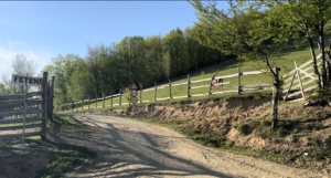
Feteni, Cugir, Alba, Romania
Yes. Romania has both the raw material and a real, demonstrated demand for greenways, but still lacks the systematic masterplanning culture that turns isolated projects into a coherent network. On the supply side, the country has exactly the kind of assets that fuelled the European greenway movement: an inherited network of narrow-gauge and secondary railway lines that are now underused or abandoned (the Mureș County line is one concrete example), extensive river and canal corridors, and, in the Carpathians, a dense web of forestry and agro-pastoral roads directly comparable to the Alpine context. On the demand side, Via Transilvanica has already proven that Romanians and foreign visitors alike will use a well-marked, well-designed long-distance route in large numbers, and the country’s position on both EuroVelo 6 and EuroVelo 13 gives it a natural place in the wider European network.
There is also institutional momentum: the “Romania Velo” component of the National Recovery and Resilience Plan has earmarked more than €120 million toward roughly 3,000 km of cycle-tourism infrastructure, alongside a promised overhaul of cycling legislation and signposting standards. What is still largely missing is the methodical, GIS-based, phase-by-phase approach set out above — the systematic inventory of existing paths and points of interest, the stakeholder-driven network plan, and the design and signage standardisation that made Vías Verdes, the Sustrans network and the Irish and Italian examples coherent national systems rather than a patchwork of disconnected paths. Given the documented health, tourism, environmental and rural-development returns seen elsewhere in Europe, Romania should not only build greenways but should prioritise adopting this planning method itself, since that is what would convert its current funding and enthusiasm into a genuinely continuous, safe, and well-used network rather than a set of isolated local projects.